El Chaltén
Patagonia, Argentina
Explorations in
El Chaltén
Activity
Difficulty
Areas
Laguna de los huemules
Los Huemules Conservation Reserve
-
 Hike
Hike -
Easy
-
Half-day
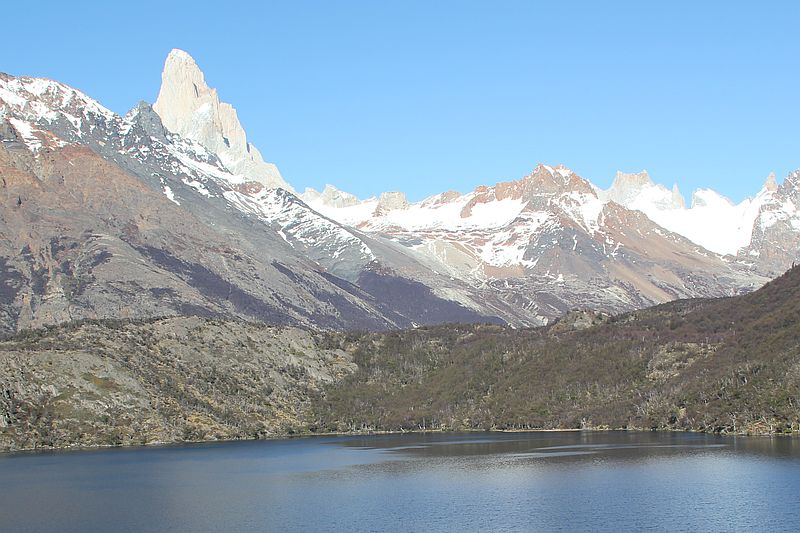
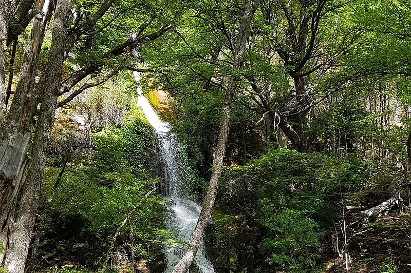
We hike from the lodge crossing a lenga and ñire forest, watching different types of birds and huemul deer tracks. We hike up to the Azul Lagoon, a water reserve that will reveal what has happened there. Different water birds will follow us along during this hike.
More details >Laguna de los huemules


-
Exploration Path
We hike from the lodge crossing a lenga and ñire forest, watching different types of birds and huemul deer tracks. We hike up to the Azul Lagoon, a water reserve that will reveal what has happened there. Different water birds will follow us along during this hike.
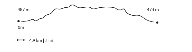
204 m 669 ft
-669 m -603 ft
603 m 1978 ft
487 m 1598 ftElevation Profile
Aves Patagónicas
Los Huemules Conservation Reserve
-
Hike
-
Easy
-
Half-day
In this exploration we will learn more about the birds of this region. We will leave by van to the Laguna Cóndor. We will walk to a viewpoint to contemplate the landscape and observe various types of birds that live there to learn more about them and their behavior. Then we will continue walking through an old lengas forest that will allow us to see other birds. We will return by van to Explora.
More details >Aves Patagónicas
-
Exploration Path
In this exploration we will learn more about the birds of this region. We will leave by van to the Laguna Cóndor. We will walk to a viewpoint to contemplate the landscape and observe various types of birds that live there to learn more about them and their behavior. Then we will continue walking through an old lengas forest that will allow us to see other birds. We will return by van to Explora.
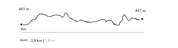
151 m 495 ft
-133 m -436 ft
500 m 1640 ft
466 m 1529 ftElevation Profile
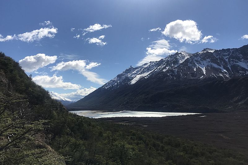
Laguna Cóndor
Los Huemules Conservation Reserve
-
Hike
-
Easy
-
Half-day
An ancient lenga tree forest welcomes us to this exploration where birds take main stage in several spots along the way.
More details >Laguna Cóndor
-
Exploration Path
An ancient lenga tree forest welcomes us to this exploration where birds take main stage in several spots along the way. The tour continues upward through a rock cliff offering unique views and perspectives to the Las Vueltas River valley.
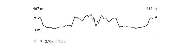
151 m 495 ft
-133 m -436 ft
500 m 1.640 ft
466 m 1.529 ftElevation Profile
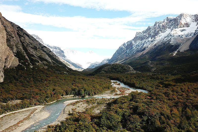
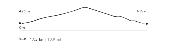
Valle de Granito
Parque Nacional Los Glaciares
-
Hike
-
Moderate
-
Full-day
We walk to the Los Glaciares National Park through a trail surrounded by forests with views to the area’s glaciers.
More details >Valle de Granito

-
Exploration Path
We walk to the Los Glaciares National Park through a trail surrounded by forests with views to the area’s glaciers. We will get an ample view of the Los Andes Mountain Range, with Mount Fitz Roy taking center stage. We finalize the hike at the town of El Chaltén and take the van back to the lodge.
Los Valles
Parque Nacional Los Glaciares
-
Hike
-
Expert
-
Full-day
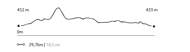
We cross the Blanco river valley, then we hike up to the los tres lagoon. Enjoy an impressive view of Mount Fitz Roy.
More details >Los Valles

-
Exploration Path
An Explora van will take us to the northernmost tip of the Los Glaciares National Park. From there, we begin crossing the Blanco River valley. We then hike up to the Los Tres Lagoon, enjoying an impressive view of Mount Fitz Roy. We then follow the valley to the Torre Lagoon. We reach El Chaltén after one day with different lookouts within the Los Glaciares National Park, to return to the lodge by van.
1222 m 4009 ft
-1249 m -4098 ft
1.178 m 3.865 ft
426 m 1.398 ftElevation Profile
Lago del desierto
Lago del Desierto
-
Hike
-
Advanced
-
Full-day
We hike in the northernmost tip of the lake and take a rugged track through the forest, reaching some of the most unexplored parts of this area.
More details >Lago del desierto

-
Exploration Path
We take a van from the lodge to the south shore of the Desierto Lake. From there, we cross this historical lake while enjoying the view of the Vespigniani Glacier. We land on the northernmost tip of the lake and take a rugged track through the forest, reaching some of the most unexplored parts of this area. We reach the southern edge of the lake and finalize the exploration taking a van back to the lodge.
592 m 1942 ft
-588 m -1929 ft
660 m 2.165 ft
505 m 1.657 ftElevation Profile
Glaciar Vespigniani
Lago del Desierto
-
Hike
-
Advanced
-
Full-day
We cross the desierto lake- this historical lake- while enjoying the view of the Vespigniani Glacier.
More details >Glaciar Vespigniani
-
Exploration Path
We take a van from the lodge to the south shore of the Desierto Lake. From there, we cross this historical lake while enjoying the view of the Vespigniani Glacier. We land on the northernmost tip of the lake and take a rugged track through the forest, reaching some of the most unexplored parts of this area. We reach the southern edge of the lake and finalize the exploration taking a van back to the lodge.
727 m 2385 ft
-731 m -2398 ft
983 m 3.225 ft
518 m 1.699 ftElevation Profile
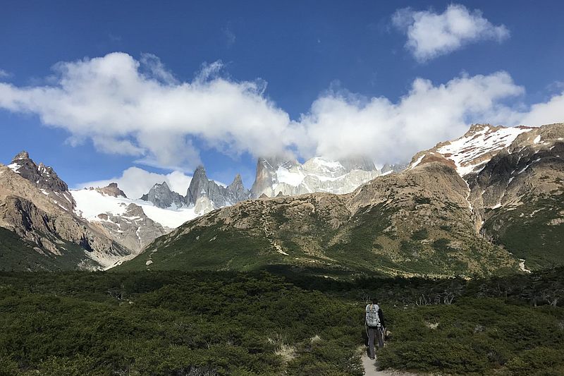
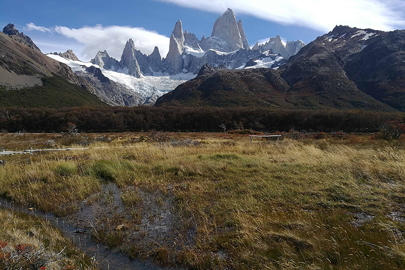
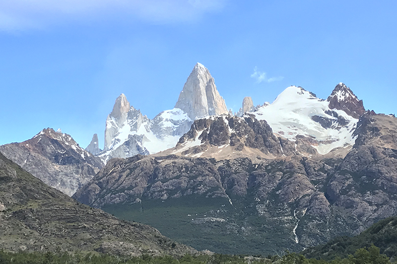
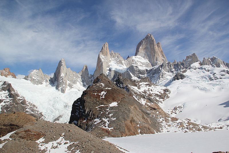
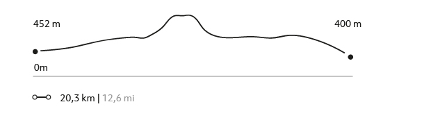
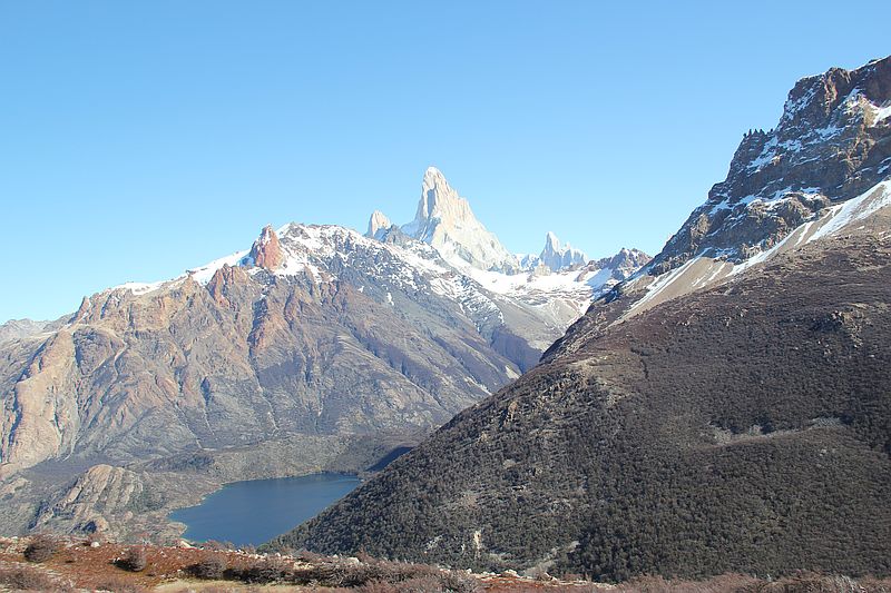
Laguna de los Tres
Parque Nacional Los Glaciares
-
Hike
-
Advanced
-
Full-day
Laguna de los Tres
-
Exploration Path
This exploration begins in one of the trails of the Los Glaciares National Park, hiking through forests and valleys up to the Los Tres Lagoon. We cross the river and begin ascending to the lagoon, where we will admire the magnificence of Mount Fitz Roy at its fullest.
991 m 3251 ft
-1035 m -3396 ft
1.178 m 3.865 ft
401 m 1.316 ftElevation Profile
El Pliegue
Parque Nacional Los Glaciares
-
Hike
-
Advanced
-
Full-day
We begin in the south area of the Los Glaciares National Park, taking a trail to different valleys and a rise with a broad view to the Torre Mount.
More details >El Pliegue
-
Exploration Path
We begin in the south area of the Los Glaciares National Park, taking a trail to different valleys and a rise with a broad view to the Torre Mount, the Viedma Lagoon, and the Las Vueltas River valley. An ideal exploration to sit quietly and contemplate the mountains.
931 m 3054 ft
-931 m -3054 ft
1.286 m 4.219 ft
396 m 1.299 ftElevation Profile
Laguna Torre
Parque Nacional Los Glaciares
-
Hike
-
Advanced
-
Full-day
From one of the accesses to El Chaltén, we hike up a trail and get an ample view to the Torre Mount.
More details >Laguna Torre
-
Exploration Path
From one of the accesses to El Chaltén, we hike up a trail to a valley with shrub-like vegetation and get an ample view to the Torre Mount.
510 m 1673 ft
-510 m -1673 ft
640 m 2.100 ft
426 m 1.398 ftElevation Profile
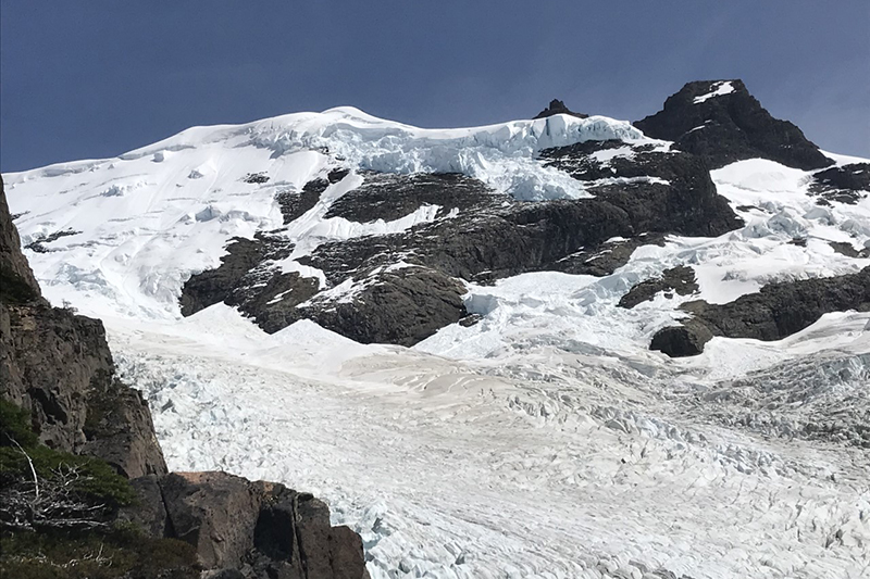
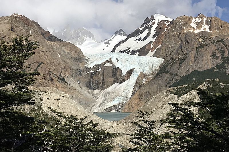
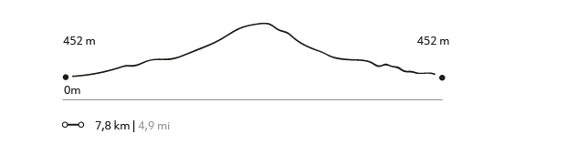
Piedras Blancas
Parque Nacional Los Glaciares
-
Hike
-
Moderate
-
Half-day
After a hike, we enjoy a view to the Piedras Blancas Glacier while learning about its history, formation, and dynamics.
More details >Piedras Blancas
-
Exploration Path
We take a van from the lodge and then begin our hike from the northern area of the Los Glaciares National Park. As we enter the forest, we enjoy a closer view to the Piedras Blancas Glacier while learning about its history, formation, and dynamics.
287 m 942 ft
-286 m -938 ft
704 m 2.310 ft
452 m 1.483 ftElevation Profile
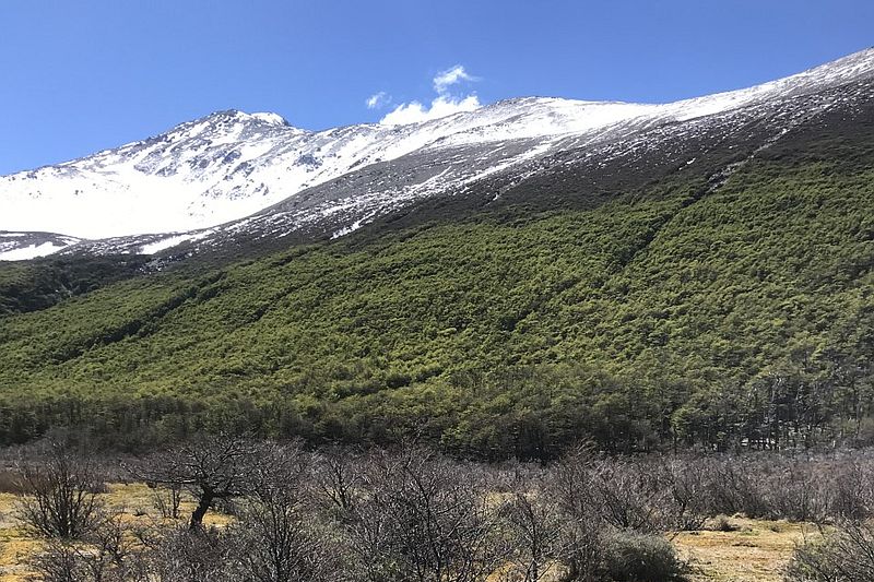
Huemules
Los Huemules Conservation Reserve
-
Hike
-
Advanced
-
Full-day
Huemules
-
Exploration Path
We take a slightly rugged track from the lodge to the Azul lagoon. Amidst rivers, mountains, and lagoons we amaze ourselves at the sight the north face of Mount Fitz Roy, while we continue our hike to the Diablo Lagoon. Finally, we reach a lookout with an ample view to the Cagliero Glacier, completing this full-day exploration to the Los Huemules Nature Reserve.
796 m 2612 ft
-796 m -2612 ft
812 m 2.664 ft
487 m 1.598 ftElevation Profile
El Filo
Los Huemules Conservation Reserve
-
Hike
-
Advanced
-
Full-day
El Filo
-
Exploration Path
This exploration provides an overhead view of the north face of Mount Fitz Roy. We hike along the edge of one of the hills bordering the Diablo River, arriving to an altitude ecosystem with shrub-like forests, rocks, and sand fields. We get a great view of the glaciers, mountains, and valleys of the Diablo and Las Vueltas rivers.
574 m 1883 ft
-574 m -1883 ft
1.022 m 3.353 ft
463 m 1.519 ftElevation Profile
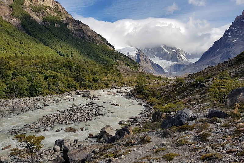
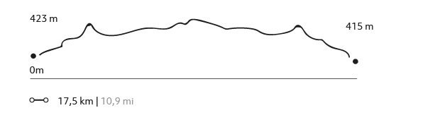
Bahía Tranquila
Lago del Desierto
-
Hike
-
Moderate
-
Full-day
Bahía Tranquila
-
Exploration Path
Following the Las Vueltas River amidst ancient forests, we will go to the northern area of El Chaltén. We will border the Desierto Lake, a watershed adjacent to forests and foothills of the Los Andes Mountain Range, to enjoy the views to two glaciers: Vespigniani and Huemul. Finally, we return through the same track to the van that will take us back to the lodge.
423 m 1388 ft
-415 m -1362 ft
593 m 1.946 ft
510 m 1.673 ftElevation Profile
Mirador Cerro Torre
Parque Nacional Los Glaciares
-
Hike
-
Moderate
-
Full-day
In this exploration we can observe the marks of a retreating glacier and the impressive Los Andes Mountain Range.
More details >Mirador Cerro Torre
-
Exploration Path
We begin the hike from an access to the Los Glaciares National Park, taking an upward trail sided by bushes that provides ample views to the Torre Mountain. In this exploration we can observe the marks of a retreating glacier and the impressive Los Andes Mountain Range. We will also have time to photograph in detail the Patagonia landscapes and wildlife.
258 m 846 ft
-258 m -846 ft
613 m 2.011 ft
425 m 1.394 ftElevation Profile
-
Other options: