Sacred Valley
Machu Picchu & Sacred Valley, Peru
Explorations in
Sacred Valley
Activity
Difficulty
Areas
Ollantaytambo
Quechua
-
 Hike
Hike -
Easy
-
Half-day
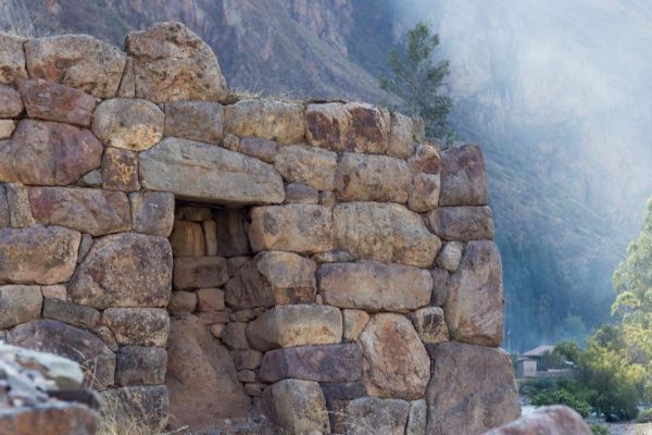
The walk takes us through the living Inca town of Ollantaytambo. The trail passes through the old main gate and over cobblestone streets...
More details >Ollantaytambo


-
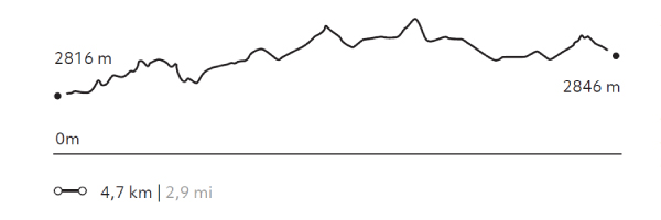
Exploration Path
The walk takes us through the living Inca town of Ollantaytambo. The trail passes through the old main gate and over cobblestone streets framed by narrow water channels. After visiting the village, we climb to the archaeological site to see its terraces, the ceremonial center and the Royal Building.
177 m 581 ft
-146 m -479 ft
2.885 m 9.465 ft
2.816 m 9.239 ftElevation Profile
Huertos de Yucay
Quechua

-
Hike
-
Easy
-
Half-day
The exploration begins at Yucay, the former residence of the prominent Inca rulers Tupac Inca Yupanqui, Huaynacapac and Sayritupac...
More details >Huertos de Yucay
-
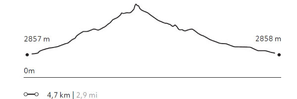
Exploration Path
The exploration begins at Yucay, the former residence of the prominent Inca rulers Tupac Inca Yupanqui, Huaynacapac and Sayritupac, and abundant crop fields. The trail takes you to the area’s platforms and crop fields.
224 m 735 ft
-224 m -735 ft
3.051 m 10.010 ft
2.857 m 9.373 ftElevation Profile
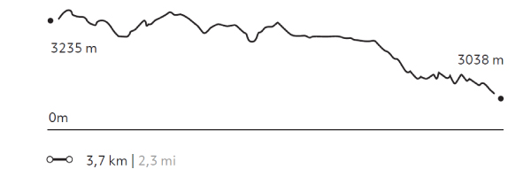
Arin
Quechua
-
Hike
-
Easy
-
Half-day
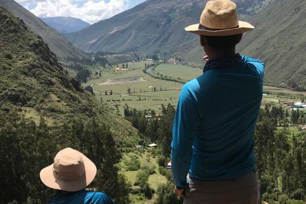
Our hike begins in Huarán, on a narrow path that runs along an irrigation channel and different crops, with views of the valley and its ravines...
More details >Arin
-
Exploration Path
Our hike begins in Huarán, on a narrow path that runs along an irrigation channel and different crops, with views of the valley and its ravines; among them, that of Urquillos. We continue skirting the channel through forests of eucalyptus and smallholdings, until we come to a path by which we descend. Finally, we reach the community of Arín. We return to Explora by van.
* Not recommended for travelers with fear of heights.
332 m 1.089 ft
-529 m -1.736 ft
3.253 m 10.673 ft
3.038 m 9.967 ftElevation Profile
-
Other options: