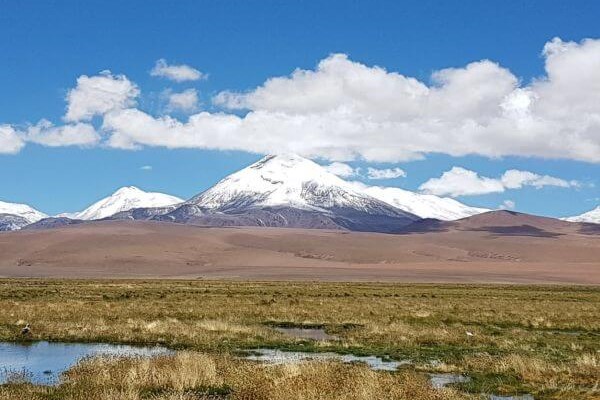
Atacama
Desert & Altiplano, Chile
Explorations in
Atacama
Activity
Difficulty
Areas
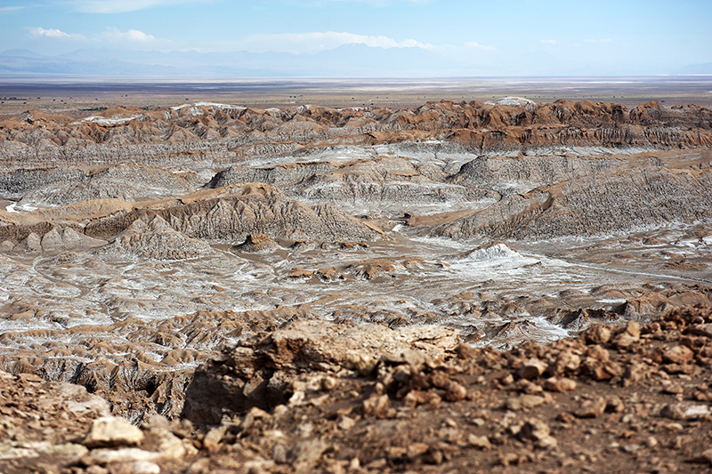
Valle de la Luna
Cuenca del salar

-
 Horseback Ride
 -
Advanced
-
Half-day
We travel to the Salt Mountain Range, going through different dunes and rock formations. As we go along, among trots and gallops...
More details >Valle de la Luna


-
Exploration Path
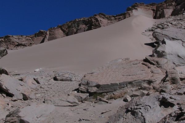
We travel to the Salt Mountain Range, going through different dunes and rock formations. As we go along, among trots and gallops, we ride into the Moon Valley, a site whose lunar landscapes have given Atacama its worldwide fame. During this ride, we explore pristine and solitary landscapes.
For experienced and advanced riders only. This exploration is only available for advanced riders who have mastered rising trot and canter over uneven terrain in open spaces and on all types of horses. A test in the hotel is required before going out into the desert.
*Temporarily unavailable. Consult other exploration options with your Explora guide at the destination.
380 m 1246 ft
-379 m -1243 ft
2.555 m 8.380 ft
2.408 m 7.898 ftElevation Profile
Cordillera de la Sal
Cuenca del salar
-
Overland
-
Easy
-
Half-day
We take a van to the Salt Mountain Range to see typical desert landscapes: open reddish clay grounds, sand dunes...
More details >Cordillera de la Sal


-
Exploration Path
We take a van to the Salt Mountain Range to see typical desert landscapes: open reddish clay grounds, sand dunes, and sedimentary rock formations. We walk up to the highest point of this mountain range to see the panoramic views. We will take a 30 minute walk through one the least known mountainsides of the Salt Ridge.
Gran Salar
Cuenca del salar
-
Overland
-
Easy
-
Half-day
We leave in a van to Toconao, located to the south of San Pedro de Atacama. We walk to the village square and then through an area...
More details >Gran Salar
-
Exploration Path
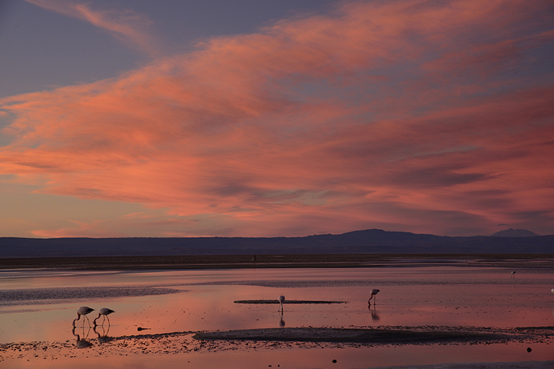
We leave in a van to Toconao, located to the south of San Pedro de Atacama. We walk to the village square and then through an area of vegetable gardens. We finally take a van to the Chaxa Lagoon, located in the Los Flamencos National Reserve, an ideal place for bird watching within Atacama’s Salt Flat.
Tebenquinche
Cuenca del salar
-
Overland
-
Easy
-
Half-day
Departure from Explora by van to the northern part of the Salar de Atacama arriving at the Tebenquinche lagoon, habitat for various birds...
More details >Tebenquinche
-
Exploration Path
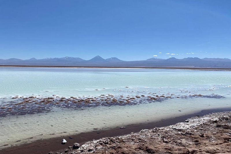
Departure from Explora by van to the northern part of the Salar de Atacama arriving at the Tebenquinche lagoon, habitat for various birds in the area. We can walk along the lagoons to learn more about these special formations with views of the Andes. We will continue by van to Céjar, the salty lagoon where we can bathe and float.
Kunza
Cuenca del salar
-
Overland
-
Easy
-
Half-day
In this exploration we learn about the Atacameño history and culture. We start with a guided tour of an archaeological deposit...
More details >Kunza
-
Exploration Path
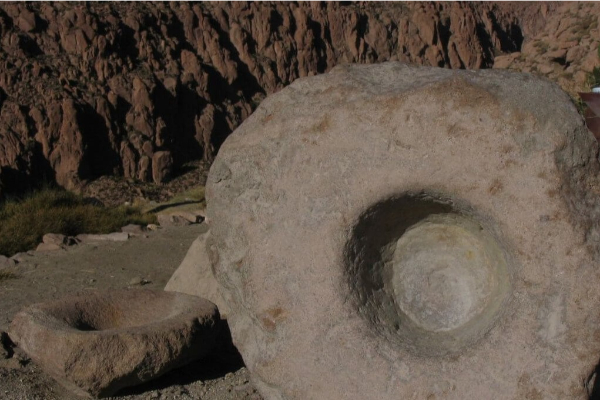
In this exploration we learn about the Atacameño history and culture. We start with a guided tour of an archaeological deposit where we can see ceramic pieces and other historical artifacts fit for a museum. Later on, we move on to the village of Tulor, one of the first settlements. We end the exploration at the mythical desert bookstore.
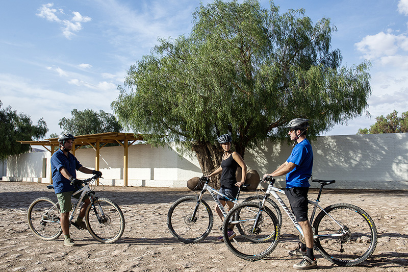
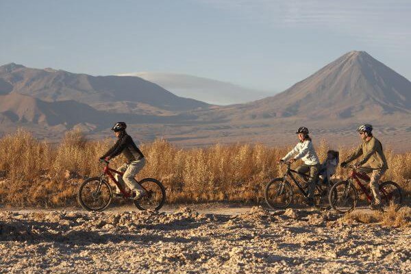
Tambo
Cuenca del salar
-
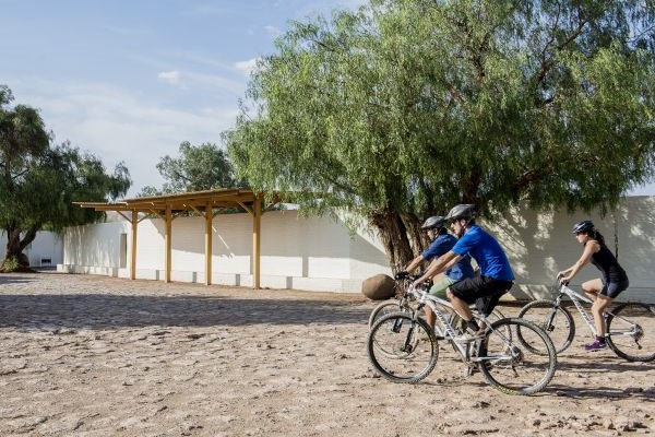
Bike
-
Expert
-
Half-day
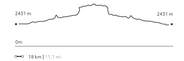
We bike ride to the Catarpe Valley. We ride up to Cuchabrache, through an old road that crosses the Salt Mountain Range...
More details >Tambo


-
Exploration Path
We bike ride to the Catarpe Valley. We ride up to Cuchabrache, through an old road that crosses the Salt Mountain Range. We ride through plaster and crystallized salt creeks. This exploration includes seeing part of the local culture and petroglyphs, as well as the San Isidro church.
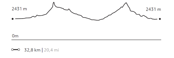
568 m 1863 ft
-568 m -1863 ft
2.690 m 8.823 ft
2.431 m 7.974 ftElevation Profile

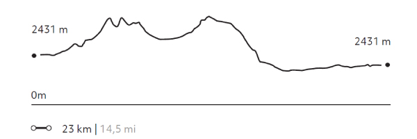
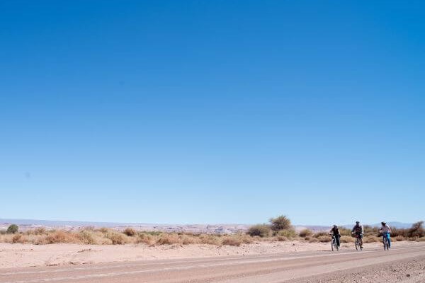
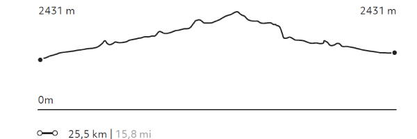
San Isidro
Cuenca del salar
-
Bike
-
Moderate
-
Half-day
We ride our bicycles to the Catarpe Valley in the Salt Ridge. We pedal through switch paths between canyons...
More details >San Isidro

-
Exploration Path
We ride our bicycles to the Catarpe Valley in the Salt Ridge. We pedal through switch paths between canyons made of reddish soil in a place known as Garganta del Diablo (Devil’s Throat). We visit the San Isidro church into a historic area.
325 m 1066 ft
-325 m -1066 ft
2.584 m 8.476 ft
2.431 m 7.974 ftElevation Profile
Catarpe
Cuenca del salar
-
Bike
-
Easy
-
Half-day
We bike ride to the San Pedro River and follow its course to Catarpe. We go through the Quitor pukará...
More details >Catarpe
-
Exploration Path
We bike ride to the San Pedro River and follow its course to Catarpe. We go through the Quitor pukará, an old fortress, and cross the Garganta del Diablo (Devil’s Throat), a canyon inside the Salt Mountain Range with zigzagging paths between striking rock formations. We return through the same road.
244 m 800 ft
-244 m -800 ft
2.546 m 8.351 ft
2.431 m 7.974 ftElevation Profile
Ckuta
Cuenca del salar
-
Bike
-
Moderate
-
Half-day
We take a van to the Salt Mountain Range and begin bike riding in the Paciencia plains. We travel to the Moon Valley through...
More details >Ckuta
-
Exploration Path
We take a van to the Salt Mountain Range and begin bike riding in the Paciencia plains. We travel to the Moon Valley through sandy soil and beautiful landscapes. The return trip is an uneven path that includes different ascents and descents.
251 m 823,3 ft
-240 m -787 ft
2.488 m 8.161 ft
2.366 m 7.760 ftElevation Profile
Piedra de la Coca
Cuenca del salar
-
Bike
-
Advanced
-
Half-day
We leave by bicycle to Catarpe through a road that goes up to the Salt Mountain Range. We go through an ancient tunnel...
More details >Piedra de la Coca
-
Exploration Path
We leave by bicycle to Catarpe through a road that goes up to the Salt Mountain Range. We go through an ancient tunnel before starting a descent that will take us to the Piedra de la Coca, a site with petroglyphs. We continue our trip to the Paciencia plains through stony grounds and on our way back we pass through the Mars Valley.
560 m 1836,8 ft
-560 m -1837 ft
2.642 m 8.666 ft
2.431 m 7.974 ftElevation Profile
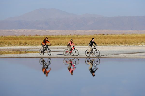
Cejar
Cuenca del salar
-
Bike
-
Easy
-
Half-day
We leave by bike from Explora, we will cross different ayllus (old social and agricultural communities atacamañeñas) to enter...
More details >Cejar
-
Exploration Path
We leave by bike from Explora, we will cross different ayllus (old social and agricultural communities atacamañeñas) to enter the northern part of the Atacama salt flat to one of its first lagoons, Laguna Cejar. We can bathe in one of its lagoons.
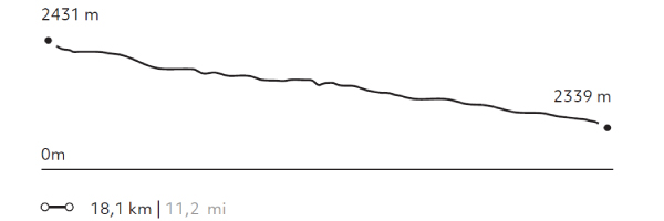
42 m 137,1 ft
-126 m -413 ft
2.431 m 7.974 ft
2.339 m 7.672 ftElevation Profile
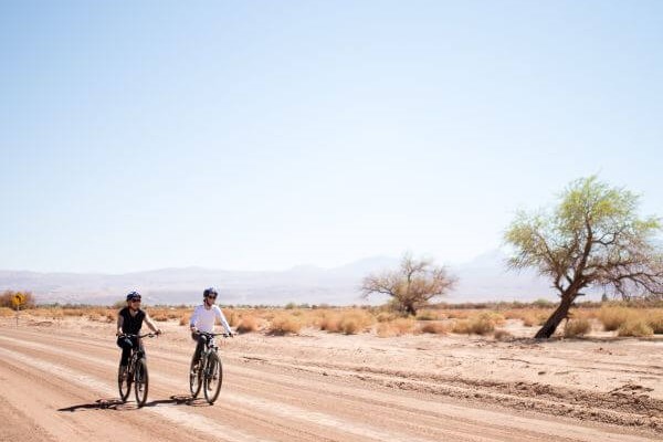
Ayllus
Cuenca del salar
-
Bike
-
Easy
-
Half-day
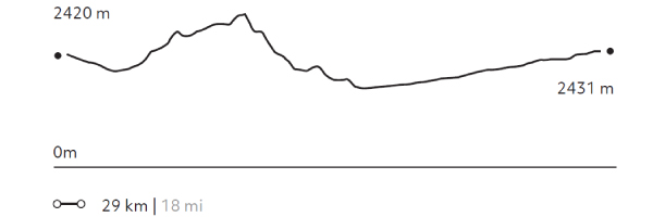
We bike ride to the archaeological site of Beter, one of the first Atacameño settlements. We get off the bicycle to visit the site and learn about...
More details >Ayllus
-
Exploration Path
We bike ride to the archaeological site of Beter, one of the first Atacameño settlements. We get off the bicycle to visit the site and learn about the local history. Next, we continue to the ayllu in Solor to visit the Librería del desierto, the first rural book store in Chile. We return to the hotel by bicycle.
119 m 390 ft
-119 m -390 ft
2.431 m 7.974 ft
2.385 m 7.823 ftElevation Profile
Rio Salado
Cuenca del salar
-
Horseback Ride
-
Advanced
-
Full-day
We gallop to the Catarpe Valley through the San Pedro de Atacama oasis, towards the Salt Mountain Range...
More details >Rio Salado
-
Exploration Path
We gallop to the Catarpe Valley through the San Pedro de Atacama oasis, towards the Salt Mountain Range. We go through an archeological site of great value and, after lunch, we go down to the Salado River following its course till its confluence with the Grande River. On our way there, we can see petroglyphs. Afterwards we return to Explora.
For experienced and advanced riders only. This exploration is only available for advanced riders who have mastered rising trot and canter over uneven terrain in open spaces and on all types of horses. A test in the hotel is required before going out into the desert.
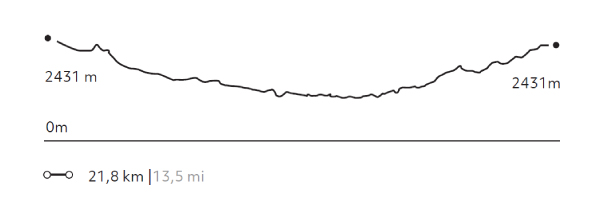
422 m 1384 ft
-422 m -1384 ft
2.686 m 8.810 ft
2.431 m 7.974 ftElevation Profile
Cuchabrache
Cuenca del salar
-
Hike
-
Moderate
-
Half-day
We take a van up to the Catarpe Valley, where we begin ascending the Salt Mountain Range. On the way, we’ll see petroglyphs...
More details >Cuchabrache

-
Exploration Path
We take a van up to the Catarpe Valley, where we begin ascending the Salt Mountain Range. On the way, we’ll see petroglyphs and from the top, we can admire the green valley landscapes contrasting with the colors of Salt and Andes Mountain Ranges. This is an ideal introduction to the Atacama region. We return by van.
*Temporarily unavailable. Consult other exploration options with your Explora guide at the destination.
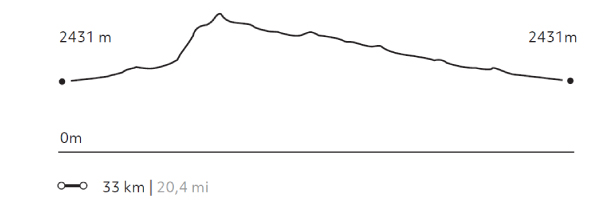
283 m 928 ft
-292 m -958 ft
2.693 m 8.833 ft
2.550 m 8.364 ftElevation Profile
Cúcuter
Cuenca del salar
-
Horseback Ride
-
Advanced
-
Full-day
We horseback ride to the Moon Valley, explore its clay grounds, and see landscapes that seem to be from another world...
More details >Cúcuter
-
Exploration Path
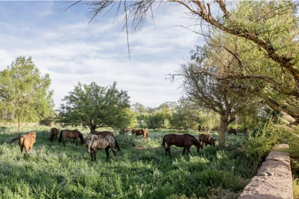
We horseback ride to the Moon Valley, explore its clay grounds, and see landscapes that seem to be from another world. Afterwards, we go for lunch to the ayllu in Cúcuter, an oasis whose colors contrast with the desert landscape and where the whitish colors of Atacama´s Salt Flat begin to appear.
*Temporarily unavailable. Consult other exploration options with your Explora guide at the destination
444 m 1456 ft
-443 m -1453 ft
2.555 m 8.380 ft
2.376 m 7.793 ftElevation Profile
-
Other options: